Trusted Surveying Services in Newcastle
For 35+ years, we’ve offered accurate, council-ready surveying solutions for rural, residential, and development projects across the Newcastle, Lake Macquarie, and Port Stephens areas.
What We Offer
If you’re looking to start a Newcastle surveying project, you’ve come to the right place! We bring a wealth of experience to every job, led by our Registered Surveyor, Anthony Clarke, who has been registered since 2005 and worked in the surveying industry since 1994 – building a strong reputation for accuracy, reliability, and professional service.
Our team works closely with homeowners, architects, builders, and developers to deliver accurate data, clear plans, and all the compliant documentation required for council approvals and construction – Ensuring every survey is completed to the highest professional standards.
Our Surveying Services:
Detail & Contour Surveys
A Detail and Contour Survey captures the physical features and elevation levels of a site.
It includes buildings, fences, trees, services, and ground contours, providing essential data for architects, engineers, and council planning. This survey is typically required when designing new builds, renovations, extensions, or developments.
Boundary Surveys
A Boundary Survey determines the exact legal boundaries of a property.
This survey ensures all structures are positioned within the correct title boundaries, and is typically required to confirm property lines before building, installing fencing, or resolving boundary disputes.
Subdivision Surveys
Subdivision Surveys are required when dividing land into two or more lots.
The process involves preparing subdivision plans, liaising with councils and authorities, and registering new titles. This survey supports both residential & industrial developments, and rural land subdivisions.
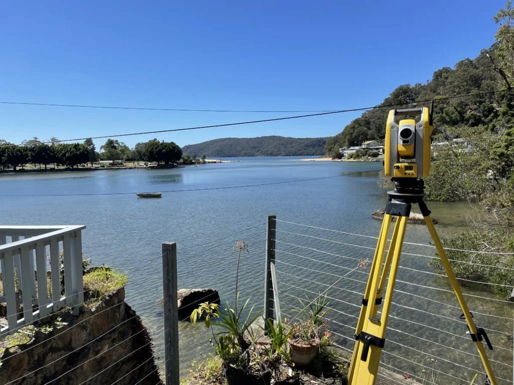
Foreshore Surveys
Foreshore Surveys are conducted on properties adjoining waterways such as rivers, lakes, or the coastline.
They assess boundary alignment relative to water features and tidal influences, and require specialised measurement and regulatory knowledge. These surveys are often required for supporting development approvals, Crown Lands license transfers, or environmental compliance.
Setout Surveys
A Setout Survey is required to mark the exact position of a proposed structure on the ground before construction begins.
Builders and certifiers rely on this survey to ensure the build aligns with approved plans and boundary setbacks. Having an accurate setout survey is a critical step in avoiding costly construction errors.
Identification Surveys
An Identification Survey confirms the location of existing structures relative to property boundaries.
It is commonly required during property purchases or sales to ensure buildings are within title limits. This survey helps solicitors and lenders verify there are no encroachments. Council will also require this survey to accompany a Building Information Certificate (BIC) application.
Floor Level Surveys
A Floor Level Survey measures the height of a building’s floor relative to a recognised datum or ground level.
Accurate floor levels are critical for planning approvals and building compliance, and this type of survey is often required for flood assessments, drainage design, or compliance with council height regulations.
Easement Creation Surveys
Easement Creation Surveys are undertaken to establish legal access or service rights over a property.
This may include drainage, sewer, power, or shared access pathways. The survey defines the easement location and prepares documentation required for title registration.
Find Out How We Can Help You…
Get in touch with us today for a consultation or a free quote on your next project!
Reach Out To Us!
Have a question or ready to start your project? We’re here to help.
Send us a message
Phone
Call us during business hours
Office
Open Mon-Fri, 8am – 5pm
1 Oscar St, Umina Beach, 2257